Trieste Map and Orientation
Trieste, Italy is a compact port city squeezed between the sea and the Karst plateau, and once you understand its three-part layout, the centre, the hill, and the coast road, almost nothing on the map is more than a short walk from anything else.
Short answer
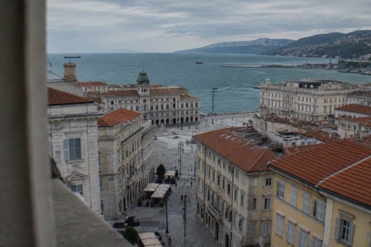
Central Trieste, Italy sits on a narrow coastal strip below the Karst plateau. The grid of the Borgo Teresiano runs from the station to Piazza Unità d'Italia, Città Vecchia and San Giusto climb the hill behind it, and the seafront Rive stretch west toward Barcola and Miramare.
Trieste, Italy is a port city on the Adriatic at the top of the Gulf of Trieste, wedged between the sea and the limestone wall of the Karst plateau, with Slovenia beginning at its eastern suburbs. That geography is the whole key to reading its map. The city has no sprawling ring of outer districts in the way Milan or Rome does; it is a narrow coastal strip, a hill, and a plateau, and almost everything a visitor wants sits inside the first two. This page from Trieste Travel Guide lays out the mental map: the districts, the landmarks, the arrival points, and how the pieces connect.
Where Is Trieste, Italy on the Map?
Trieste, Italy sits at the northern tip of the Adriatic Sea, in the region of Friuli Venezia Giulia, roughly where Italy, Slovenia and Croatia meet. The city centre lies on a narrow coastal strip below the Karst plateau, and the Slovenian border runs so close that the village of Muggia, still in Italy, and the Slovenian coast at Koper face each other across a bay. Vienna-style Habsburg planning shaped the grid you will actually walk.
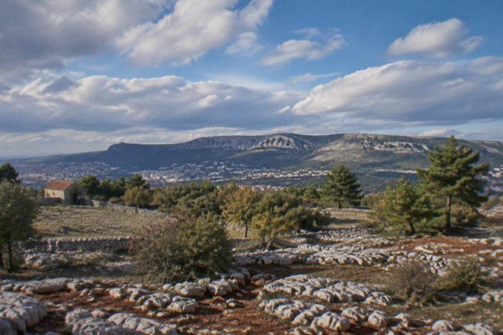
Look at any map of the northern Adriatic and Trieste is the last Italian city before the coastline turns south-east into Istria. The Gulf of Trieste is a shallow, nearly enclosed arm of the sea, and the city wraps its northern shore. Behind it, the land climbs fast: the Karst, a limestone plateau the Italians call the Carso and the Slovenians Kras, rises directly above the rooftops. That plateau is why the city is long and thin rather than round. It can only grow east to west along the water.
The border context matters more here than anywhere else in Italy. Slovenia is not a distant neighbour but an adjacent suburb-level reality, and Croatia lies just up the Istrian coast. All three countries use the euro, and all three are in Schengen, though Italy is running temporary checks on its land border with Slovenia through 18 December 2026 per the European Commission's register, so carry a passport or ID card even for a short hop across. Our page on getting around Trieste, buses, tram and taxis covers the practical side of that.
How Is Central Trieste Laid Out District by District?
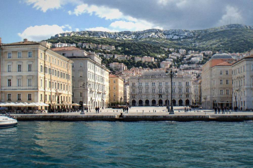
Central Trieste divides into three walkable zones: the Borgo Teresiano, the neoclassical grid of canals, squares and cafés built under the Habsburgs around the Grand Canal; Città Vecchia, the medieval old town stacked on the hill of San Giusto behind it; and the Rive, the seafront promenade running from Piazza Unità d'Italia west toward Barcola. Everything else on the map, the railway station, the cruise terminal, the Opicina tram, hangs off these three.
The Borgo Teresiano is where most visitors spend their first hours, and it is the easiest district to navigate in Italy because it is a grid. Two grand axes, via San Michele and Corso Italia, cross it, the Grand Canal cuts through the middle, and the Serbian Orthodox church of Saint Spyridon anchors its main square. Piazza Unità d'Italia, the vast sea-facing square that opens onto the Rive, forms its southern edge. This is the Trieste of the historic caffè, of insurance-company palaces and of the Borsa.
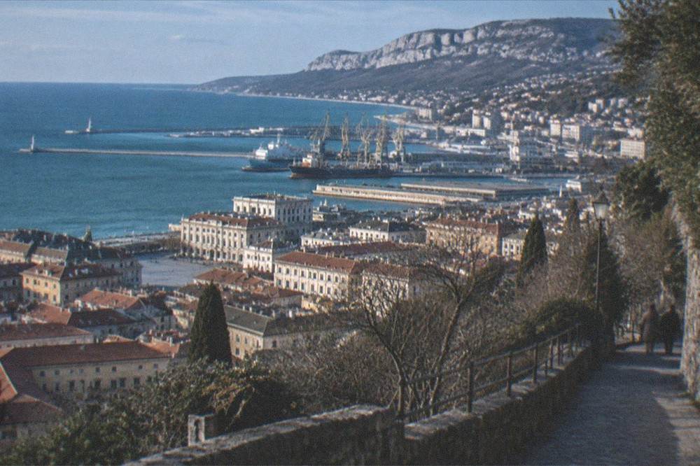
Città Vecchia climbs the hill immediately behind. Its lanes, steps and Roman remains cluster below the Cathedral of San Giusto and the Castello di San Giusto at the top, which are the two highest points on the central map and the best landmarks to orient by: from the castle walls you can read the whole city at a glance, the grid below, the gulf in front, the Carso behind. The old town district guide and the Borgo Teresiano district guide unpack each in detail.
The Rive, the long seafront, run from the Molo Audace pier beside Piazza Unità west and north toward Barcola, the residential seafront strip, and on toward Miramare Castle up the coast. The Rive seafront guide covers the walk.
| District | Character | Key landmarks | Orientation tip |
|---|---|---|---|
| Borgo Teresiano | Neoclassical Habsburg grid | Grand Canal, Piazza della Borsa, Saint Spyridon church | Flat, regular streets, easiest part of the city to navigate |
| Città Vecchia | Medieval lanes and steps | Arco di Riccardo, Roman theatre, Cathedral of San Giusto | Climb uphill from Piazza Unità, the castle is the top |
| Rive and Molo Audace | Seafront promenade | Molo Audace, Piazza Unità d'Italia | Follow the water, it runs in one continuous line toward Barcola |
| Barcola | Residential seafront strip | Beach platforms, the long lungomare | Reached by continuing north-west along the water |
| San Giusto hill | Monumental hilltop | Castello di San Giusto, cathedral, bastions | Visible from almost everywhere below |
| Porto Vecchio | Former port, industrial heritage | Warehouses and docks opened to the public in recent years | East of the centre, toward the new port gates |
Which Trieste District Should a First-Time Visitor Stay In?
Most first-time visitors to Trieste should stay in the Borgo Teresiano, the grid between the railway station and Piazza Unità d'Italia, because it puts the cafés, the Grand Canal and the seafront within a flat walk and the station on the doorstep. Città Vecchia is quieter and more atmospheric but uphill, and Barcola suits a beach-focused summer stay rather than a sightseeing one.
The Borgo Teresiano's practical advantage is the station. Trieste Centrale sits at the inland edge of the grid, and the walk from its forecourt down to the sea is a straight, flat line through the district, so a hotel anywhere on that grid means the station, the terminal and the square are all reachable on foot. The where to stay in Trieste guide sorts the options by budget and travel style.
One map-level note that surprises people: the city is smaller than it photographs. The distances in the centre are short, and the hill, though steep, is climbed in minutes rather than hours. What stretches the map is the coast road to Miramare and the plateau above, and those are the two directions where you should think about transport rather than walking. A private walk with a local guide is one way to have the geography explained on the ground; the Trieste Private Walking Tour with a Local runs two to six hours from $56.05 per person, rated 4.6 from 94 reviews on the operator's live listing.
If you would rather have the map walked for you, the Jewish heritage walking tour is a private-group option that threads the historic quarters east of the grid, from $194.89 per group of up to 3, rated 5 from 4 reviews, with the operator's live listing carrying current availability.
How Do You Find Your Way Around Trieste on Foot?
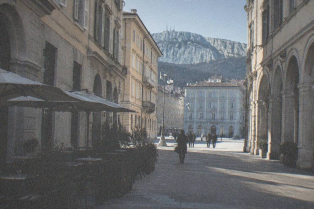
Trieste is one of Italy's most walkable cities for the simple reason that its centre is flat, compact and gridded: the Borgo Teresiano is a regular street plan, the sea is always visible from its southern edge, and the hill of San Giusto is a constant landmark behind you. The two orientation anchors to memorise are Piazza Unità d'Italia on the water and the Castello di San Giusto above.
Between those two points, everything in the historic core is signposted and hard to miss. The Roman theatre is visible from the street on via del Teatro Romano, you look down into it rather than entering it, and the Arco di Riccardo stands in a lane of the old town. Walk downhill from the castle in any direction and you reach the grid; walk downhill in the grid in any direction and you reach the sea. It is a city where getting genuinely lost takes effort.
The one place where the map needs care is the boundary between the old town's lanes and the modern grid, where a few streets narrow into steps. That is the only part of the centre where a paper map or an offline phone map earns its keep. For a self-guided option, the Trieste Walking Tour with Audio and Written Guide by a Local costs from $7.59 per person, rated 4.5 from 105 reviews, and leaves you free to set your own pace. The self-guided walking tour itinerary on this site gives a free route with the same logic.
| Central landmark | District | Best used as |
|---|---|---|
| Piazza Unità d'Italia | Rive | Main orientation point, sea-facing |
| Castello di San Giusto | San Giusto hill | Hilltop reference, visible citywide |
| Grand Canal and Sant'Antonio Taumaturgo | Borgo Teresiano | Midpoint of the grid |
| Piazza della Borsa | Borgo Teresiano | Café and commerce quarter marker |
| Molo Audace | Rive | Seafront pier beside the main square |
| Roman theatre | Città Vecchia | Old town waypoint on via del Teatro Romano |
| Arco di Riccardo | Città Vecchia | Roman arch in the lanes below the hill |
Where Do Trains, Cruise Ships and the Airport Sit on the Map?
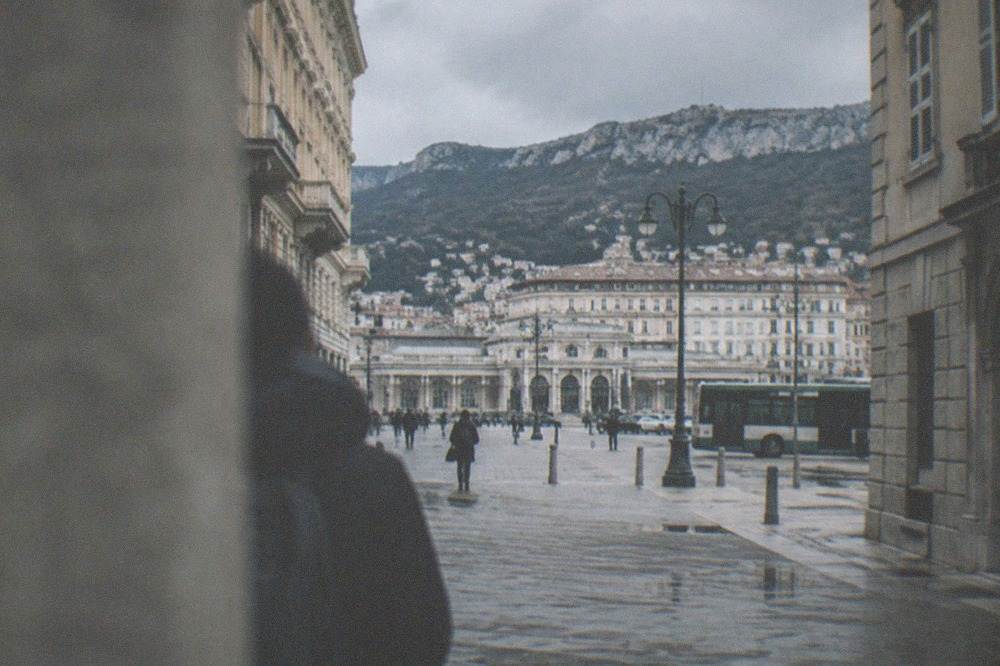
Trieste Centrale station sits at the inland edge of the Borgo Teresiano grid, a short flat walk from Piazza Unità d'Italia; cruise ships dock at the port terminals just east and north of the main square, close enough that passengers walk into the centre; and Trieste Airport lies north-west at Ronchi dei Legionari, connected to its own railway station by a covered walkway of roughly 400 metres with moving walkways.
The station is the easiest arrival point to read on the map. Its forecourt opens on to via Miramare and the grid, and the walk to the sea is a straight line down through the district. The train station and rail connections guide covers where the lines run, including the Venice route our Trieste to Venice by train page details.
The cruise port is, unusually for a port city, central. The terminals sit on the water side of the grid and the old port, the Porto Vecchio, wraps the shoreline east of Piazza Unità, a district only opened to the public in recent years. Disembarking passengers do not need a transfer into town, which our cruise port guide and the one day ashore itinerary both build on.
The airport is the one arrival point that is genuinely off-map. Trieste Airport at Ronchi dei Legionari has its own station joined to the terminal by that covered walkway, served by regional, Intercity and high-speed trains, and the airport guide and flights to Trieste pages handle the rest. Do not trust any published transfer time to the centre that a timetable does not state; check the operator's own planner.
How Does Public Transport Fit the Trieste Map?
Trieste's urban transport is run by Trieste Trasporti, and the fares on its 2026 tariff sheet are simple: a 60-minute single costs €1.50, a 75-minute single €1.85, a day ticket €3.35, ten rides €13.50 and twenty rides €16.65, with contactless bank cards tap-able on board and the system applying the cheapest applicable fare. The one line worth knowing by name is the Opicina tram, urban line 2, which runs from piazza Dalmazia up the plateau to Opicina.
The tram is the map's most useful single line because it solves the one problem the geography creates: the plateau. The tram de Opicina was reactivated on 1 February 2025 after its long stop, and Trieste Trasporti's line-2 page carries a current timetable, dated 20 July 2026, for the route between piazza Dalmazia and Opicina, a run of about 5.175 km. Note the terminus carefully, because almost every older guide gets it wrong: the city end is piazza Dalmazia, not piazza Oberdan. It is part of the ordinary urban network, so a standard ticket is valid. Check the operator's own site for the live status rather than trusting any printed claim about closures. The Opicina tram and obelisk guide has the full story.
Buses fill in the rest of the map, including the seafront services toward Barcola and the cross-border routes into Slovenia. For the fare table and how the tickets work, see getting around Trieste.
| Ticket (Trieste Trasporti, 2026 urban tariff) | Price | Validity |
|---|---|---|
| Single U01 | €1.50 | 60 minutes |
| Single U02 | €1.85 | 75 minutes |
| Day ticket U24 | €3.35 | Full day |
| 10 rides U10 | €13.50 | Ten urban journeys |
| 20 rides U20 | €16.65 | Twenty urban journeys |
Singles run 60 or 75 minutes, extended to 240 minutes on Sundays and public holidays. Contactless Mastercard, Visa and American Express cards and digital wallets work on the on-board readers.
What Does the Weather Map Look Like Month by Month?
Trieste has a mild coastal climate with a July mean high of 28.2 C and a January mean high of 9.2 C, per ARPA FVG's station tables for the molo Fratelli Bandiera, 1995-2024. The bora wind, gusting from the east-north-east, is the feature that actually shapes the map in winter: the city averages 17.6 days a year with a gust over 90 km/h, and the monthly record gust exceeds 110 km/h in every single month.
For orientation purposes the weather matters in one specific way: the wind comes off the plateau, so the streets that run parallel to the coast are sheltered and the ones that open onto the water are not. The Rive in a bora are a different place from the Rive on a calm day. Our Trieste weather month by month and best time to visit Trieste guides carry the full breakdown, and the bora wind guide explains the wind itself.
| Month | Mean high C | Rain mm | Sea C | Days with a gust over 90 km/h |
|---|---|---|---|---|
| January | 9.2 | 52.8 | 11.6 | 2.4 |
| April | 16.8 | 60.7 | 14.0 | 0.7 |
| July | 28.2 | 53.8 | 25.9 | 0.9 |
| October | 19.6 | 88.6 | 20.3 | 1.4 |
| November | 14.7 | 109.8 | 16.8 | 1.9 |
The sea, measured by a separate oceanographic series, is warmest in July and August at a mean of 25.9 C, which is why the swimming map, Barcola above all, fills up in summer. The beaches and swimming guide maps the water access points.
How Do Day Trips Fit Around Trieste on the Map?
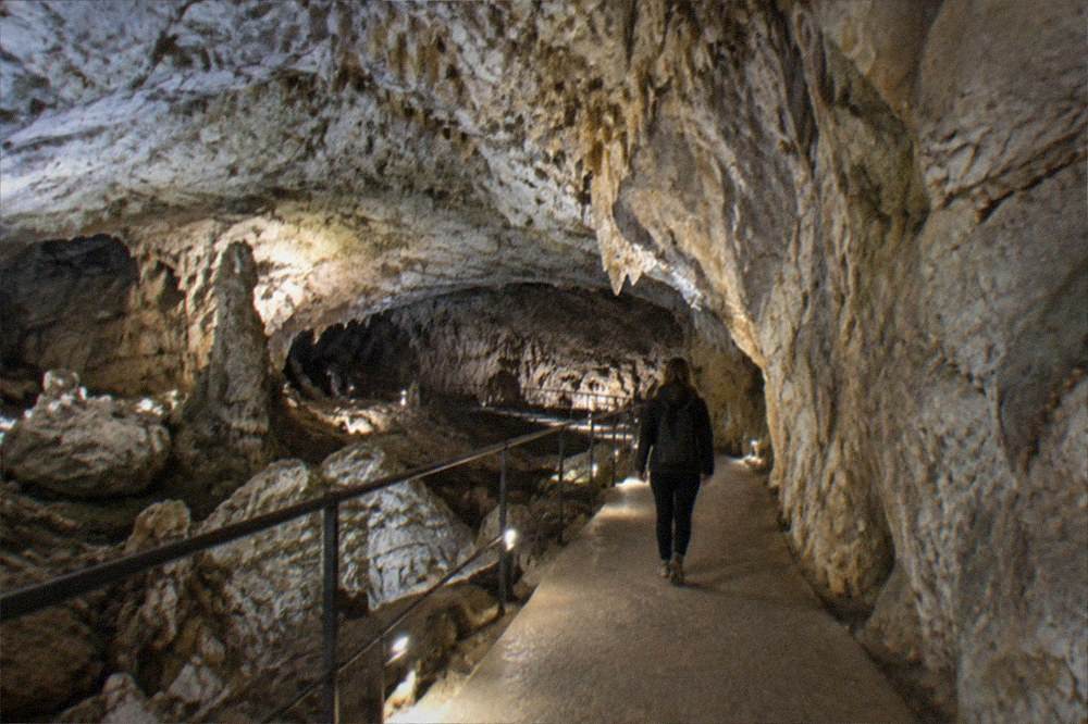
Every major day trip from Trieste leaves the map in one of three directions: north-west up the coast to Miramare Castle and Duino, north on to the plateau toward the Karst caves at Grotta Gigante, Škocjan and Postojna, and east across the Slovenian border to Ljubljana, Lake Bled and the Istrian coast at Piran. All three directions use the euro, all three are in Schengen, and the Slovenian ones need an ID card or passport because of Italy's temporary border checks running through 18 December 2026.
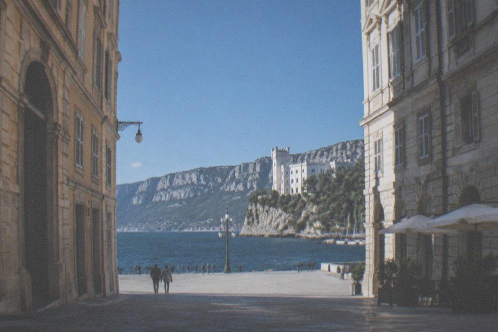
The coast direction is the simplest: the castle at Miramare sits up the shore from Barcola, with the Miramare Castle guide and the Duino and Rilke Trail guide mapping the sequence. The plateau direction is the cave country; the Carso plateau guide covers the terrain and the osmize of the Carso the farm-cellar tradition. The cross-border direction is the biggest, and our day trips from Trieste hub sorts it all.
Organized tours compress the geometry for you. The panoramic city and Miramare tour covers the centre and the castle in one four-hour sweep from $129.94 per person, rated 4.97 from 21 reviews, while the guided foodie walking tour eats its way through the grid over three hours from $71.08 per person, rated 4.91 from 264 reviews.
| Day-trip direction | Destination | Organized option from the roster |
|---|---|---|
| Up the coast | Miramare Castle and Duino | Panoramic City and Miramare Castle Tour, 4 hours, from $129.94 |
| On to the plateau | Grotta Gigante, Sgonico | Grotta Gigante guided tour with museum entry, 1 hour, from $17.20 |
| Cross-border, caves | Postojna Cave and Predjama Castle | From Trieste tour, 6 hours, from $137.57 |
| Cross-border, caves | Škocjan Caves and Lipica | Lipica and Škocjan tour, 6 hours, from $129.93 |
| Cross-border, city and lake | Ljubljana and Lake Bled | Full-day tour, 9 hours, from $108.91 |
| Cross-border, coast | Piran and the Slovenian coast | Piran and Slovenia Coast Tour, 6 hours, from $114.64 |
What Should You Pay Attention to When Reading a Trieste Map?
Three things mislead people reading a Trieste map: the scale, which makes the centre look bigger than it is; the hill, which looks trivial in contour but separates Città Vecchia from the grid with real steps; and the border, which sits so close to the eastern edge that a day trip can cross it without you noticing. None of the three is obvious from the map alone, and all three are the difference between a plan that works and one that fights the city.
The scale point is worth repeating because it changes itineraries. A first-time plan that treats Trieste as a big city, with transit legs between sights, will waste half a day. The one day in Trieste and two days in Trieste itineraries on this site are built around walking distances, and they hold up because the map is genuinely compact.
The hill point affects anyone with mobility limits or heavy bags. The lanes between the grid and the castle are stepped and steep, and the accessible route up is by road rather than lane. Our accessible Trieste guide maps the step-free alternatives.
The border point is administrative rather than physical. The line with Slovenia is invisible on the ground, but as of the European Commission's current register Italy is running temporary checks on it through 18 December 2026, so the ID card you would carry anyway is the one document the map does not show you needing. The free things to do in Trieste and unusual things to do in Trieste guides round out the low-cost and offbeat corners of the map if your plans stay inside Italy.
For a deeper cut at the same streets, the hidden gems private walking tour takes a local guide's route through the corners the standard map does not name, from $143.30 per person, rated 4.96 from 62 reviews on the operator's live listing.
Common Questions About the Map of Trieste
Is Trieste, Italy walkable from the cruise port?
Yes. The cruise terminals sit on the water side of the central grid, and the walk from the ship into the heart of the Borgo Teresiano is flat and short, with Piazza Unità d'Italia as the obvious first landmark. No transfer into the centre is needed.
Is Trieste a walkable city in general?
The flat grid of the Borgo Teresiano, the Rive and the seafront are all comfortably walkable, and the hill of San Giusto is a short but steep climb. The distances that need transport are the plateau above and the coast road toward Miramare.
Where does the Opicina tram leave from?
From piazza Dalmazia, the current city terminus, not piazza Oberdan as older guides print. The line was reactivated on 1 February 2025 and runs to Opicina on the plateau, about 5.175 km, as part of the ordinary urban network.
How close is Slovenia to Trieste on the map?
The border runs along the city's eastern edge, close enough that the Italian town of Muggia and the Slovenian coast face each other across a bay. All three neighbouring countries use the euro and are in Schengen, though Italy is running temporary checks on the Slovenia land border through 18 December 2026, so carry ID.
What is the best landmark to orient by in Trieste?
Two landmarks cover the whole city: Piazza Unità d'Italia on the water and the Castello di San Giusto on the hill. From the castle walls the entire grid, the gulf and the plateau are visible at once, which makes it the single best orientation point in Trieste.
Do I need a car to see Trieste?
Not for the city itself, which is compact and served by an urban network whose 2026 singles cost €1.50 to €1.85 and a day ticket €3.35. A car only earns its keep for a multi-stop tour of the Karst plateau or the Istrian coast at your own pace.